
Kingston ZIP Code Coverage
Only a careful three-row set is supported by the Kingston research. The city and county materials associate 12401 with Kingston. Official waterfront planning material says 12401 and 12402 extend well beyond city limits, while Port Ewen-associated 12466 includes a significant Kingston area around Rondout Creek and the waterfront. The Post Office column deliberately does not name a station because the inspected sources did not establish one for each ZIP.
| ZIP | Areas Covered | Post Office | Notes |
|---|---|---|---|
| 12401 | Standard Kingston-associated delivery in county and city materials | Not identified in the inspected source | Extends beyond city limits; exact polygon was not located. |
| 12402 | Kingston-associated alternate or PO Box route in official postal materials | Not identified in the inspected source | Test separately from street situs; delivery class and boundary map were not located. |
| 12466 | Port Ewen-associated delivery area including a significant Kingston Rondout Creek waterfront segment | Not identified in the inspected source | Partial city coverage, not a Kingston-wide ZIP. |
These are postal relationships, not boundary drawings. Exact delivery classes, ZIP+4 ranges, polygons, establishment dates, and realignment history were not located in a single authoritative Kingston source. Do not fill those gaps by sketching a line from a returned address.
Kingston ZIP Codes Are Delivery Geography
A ZIP Code is a postal delivery geography. It is not a municipal boundary, census geography, or proof of where a person lives. The distinction matters in Kingston because a city address may produce 12466, and an address using 12401 or 12402 can be outside city limits. The postal result is still useful. It standardizes a delivery address before the county parcel and assessment searches begin.
Kingston’s city geography has other layers. The city is in Ulster County and has Stockade/Uptown, Midtown, and Rondout as useful descriptive areas. It also has nine wards for current election geography. None of those names or ward lines substitutes for the parcel municipality or creates a ZIP boundary. Keep the record type beside the result so a postal label does not become a jurisdiction claim.
Note: A ZIP match supports delivery formatting, while the parcel’s municipality and situs answer the city-location question.
Use Three Kingston USPS Routes
USPS ZIP Code Lookup provides three distinct methods: By Address, By City and State, and Cities by ZIP. Use By Address to normalize a full address. Use By City and State to test postal results when the street is not yet known. Use Cities by ZIP to check the postal place returned for a known five-digit ZIP. The service also provides an alternate street-and-ZIP route.
Save both the exact query and the returned postal form. A delivery normalization result is a strong starting point for Kingston ZIP code directory work, but it should be compared with the county map and assessor situs. A USPS return does not identify the resident, prove mail receipt, or determine whether an address lies within City of Kingston limits.
| USPS route | Captured input | Required status | Use and documented limit |
|---|---|---|---|
| By Address | Street, city, state | Not stated in the inspected research | Normalize a delivery address; compare the result to parcel situs. |
| Street and ZIP route | Street and ZIP | Not stated in the inspected research | Alternate postal lookup route captured for address checking. |
| By City and State | City and state | Not stated in the inspected research | Test a postal place and its available ZIP results. |
| Cities by ZIP | ZIP | Not stated in the inspected research | Review the postal city result for a five-digit ZIP. |
The research did not capture USPS validation messages, full result columns, ZIP+4 ranges, or any Kingston polygon. Treat the current screen as the source for a fresh query rather than assuming a particular label or option remains unchanged.
Check a Kingston ZIP Code in Order
A ZIP code can narrow an address question, but the workflow needs a municipal cross-check before any property or resident conclusion. Start with delivery, then move to the parcel. The same order also keeps a mailing address from being confused with the property’s physical address.
- Run the address through USPS ZIP Code Lookup and retain the response date and postal form.
- Search the Ulster County Parcel Viewer by address, owner, or parcel number. If needed, try only the street name and narrow by section-block.
- Record the parcel number, situs, municipality, and map date. Use the parcel number to compare the county map with the assessment record.
- Check the Kingston Assessor route for the roll year, owner field, physical facts, exemptions, and a separate mailing address where displayed.
- For a recorded ownership question, follow the parcel or street trail to Ulster County land records. For a narrowed street question, use the Kingston street directory workflow.
There is no authoritative open web list of all current Kingston residents in the inspected sources. A ZIP filter does not change that limit. It helps organize postal and parcel research, not create a resident list.
Cross-Check Kingston ZIP Results
The county Parcel Viewer accepts owner name, address, and parcel number. It can open Complete Parcel Information and imagery links after a selection. If a search returns too many or no parcels, the county advises trying the owner’s last name, street name, or section-block. Its Select Parcels tool can gather multiple parcels, buffer them, download selected data, and export a table. Those features support reproducible map research after a Kingston ZIP code result has been obtained.
Image Mate is the assessment portal linked from the Kingston assessor route for comparing a parcel with assessment information.
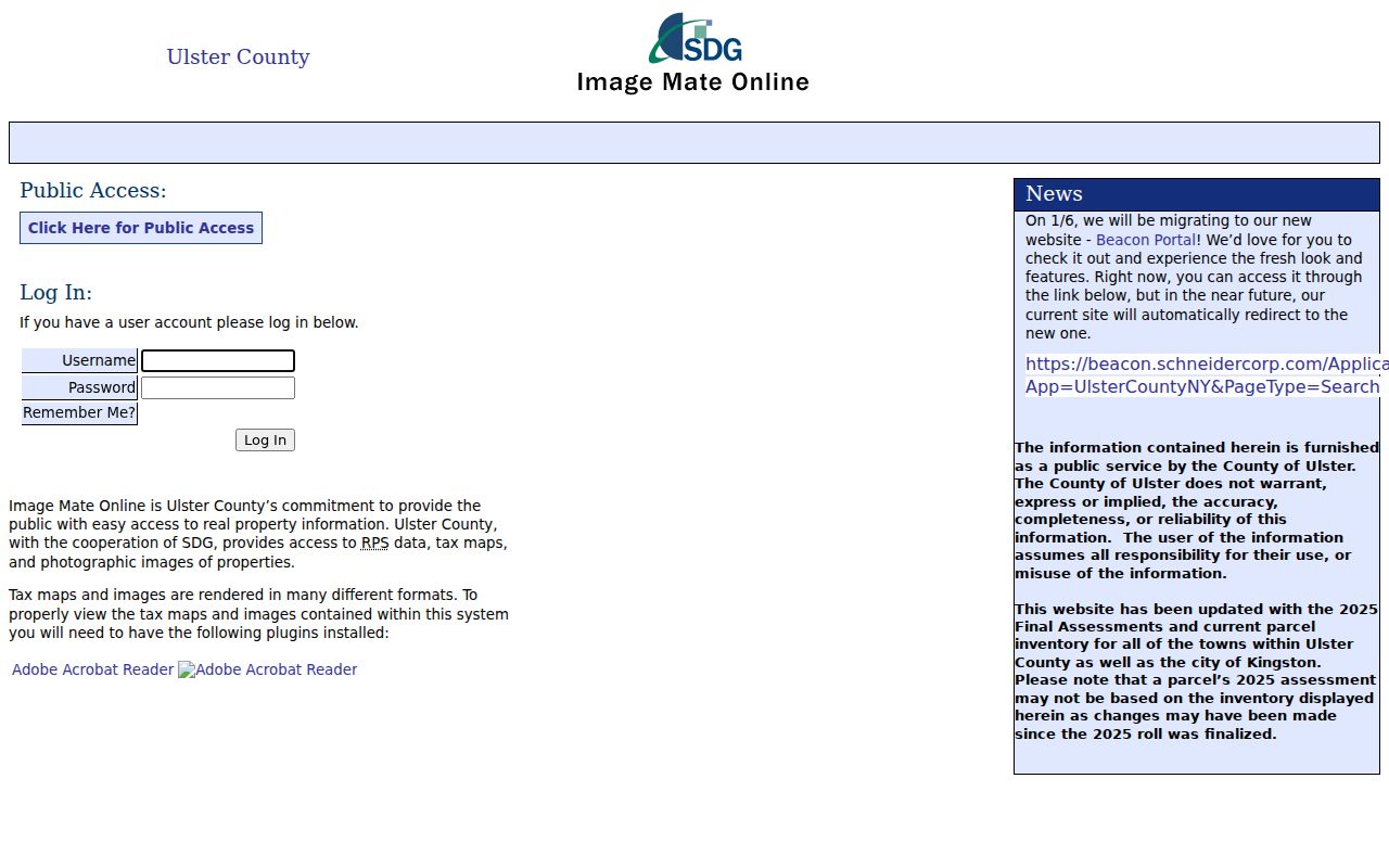
The assessment record may show an owner field, physical characteristics, exemptions, and a mailing address. It is a time-stamped roll record, so compare its date and distinguish any mailing field from situs.
Read Kingston ZIP Parcel Maps Carefully
The Parcel Viewer states that parcel boundaries and assessment information are updated January 1, May 1, and September 1. It also warns that its map data comes from multiple sources, can change, and carries no warranty. Preserve the query term, map date, layer state, parcel number, and export name. A GIS line is a useful locator, not a legal parcel survey.
The Ulster County Parcel Viewer shows the address, owner, and parcel search options that follow a Kingston ZIP code query.
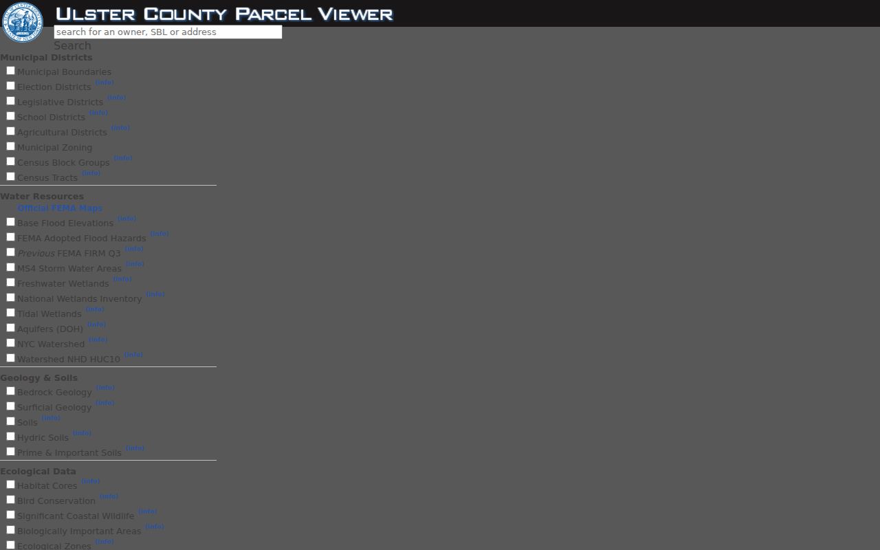
Use the map selection to identify the parcel and municipality, then consult the assessor and clerk records for time-stamped ownership and deed evidence.
Resolve Kingston ZIP and City Mismatches
If USPS returns 12466 for a waterfront or Rondout-area address, compare city or town and county in GIS with the deed or assessment situs. The city’s waterfront planning material says the Port Ewen-associated ZIP includes a significant Kingston waterfront segment. That postal result is not a reason to discard the address as outside Kingston. It is a prompt to check the parcel’s actual municipality.
The opposite mismatch also occurs. If an address carrying 12401 or 12402 appears outside the city, use the parcel municipality rather than the postal city. If the assessment record lists a different mailing address, retain both labels and explain their roles. The research does not support redrawing a ZIP boundary from one result.
- ZIP Code
- A five-digit postal delivery code. It does not by itself define the city or parcel jurisdiction.
- ZIP+4
- An added four-digit postal extension for more precise delivery sorting. No Kingston range was confirmed in the research.
- PO Box ZIP
- A postal code used for box-address delivery. The research identifies 12402 as an alternate or PO Box-related route, but did not establish its exact class.
- Unique ZIP
- A ZIP assigned for a particular organization or delivery arrangement. No Kingston ZIP was confirmed as unique in the inspected sources.
- Carrier route
- A postal delivery-sequence concept used within an area. It is not a city boundary or a statement about a resident.
Test Kingston Waterfront ZIP Results
The Rondout Creek and waterfront exception is a useful check when a postal result does not fit a simple city-name expectation. The city’s planning material connects 12466 with Port Ewen but says it includes a significant portion of Kingston, including the Rondout Creek commercial district and waterfront. Compare the USPS return, county GIS municipality, assessor situs, and deed label instead of forcing every result into one place name.
Historic research deserves the same patience. Kingston’s modern city followed the 1872 consolidation of Kingston, Rondout, and Wilbur. Older records can use the historic label for a physical place. A postal result is modern delivery evidence, while a historic deed, directory, or map should be read with its own date and jurisdiction label.
Note: Record a postal mismatch as a documented difference between systems, not as evidence that either official source is wrong.
Kingston ZIP Code Directory Limits
A Kingston ZIP code directory cannot establish municipal residence, ownership, occupancy, a surveyed parcel boundary, or a complete current resident list. Postal data verifies a delivery form. GIS locates a parcel and carries update and accuracy limits. Assessment data is tied to a roll date, and a deed records a transfer or other instrument. Combine them only after preserving which source supplied each fact.
The research did not locate exact Kingston boundary polygons, historical ZIP establishment dates, renumbering or realignment dates, ZIP+4 ranges, or a complete delivery-class table. Leave those items unresolved until a dated USPS or other authoritative postal source supplies them. A parcel map, local directory, or isolated delivery return cannot safely fill that gap. An incomplete postal record is more useful when its limits are stated plainly.
Use records carefully. Postal and parcel information can support personal, family-history, property, and civic research. Do not use a ZIP result to stalk, harass, or expose anyone.